Saturday, August 31, 2013

Day 16, Sat. Aug. 31, Wainstone Hotel, Great Broughton


Hiked 12 miles, 154 miles down, 38 miles to go
Today was another gorgeous day for hiking. I started out extremely optimistic. I decided to have my own AAA road plan and I strapped my Tevas onto my backpack in case the blisters became horrible. I also put in the new insoles I had gotten at REI that I had used early in the trip. I also have an elaborate method of taping for blisters. I was set. The first 5 miles were great. I went up hills better; my legs felt strong. The heather was in bloom;
all was well. Then we started crossing valleys. We would lose all of the elevation we had gained and another big hill would appear. It was very windy on the top of the moors. The ups were steep and the downs seemed steeper. After about five major climbs we hit a descent that was so steep I went down on part of it on all fives. A hiker who was coming up asked me if my knees were gone. Just nodded yes and didn't have the heart to tell him that my my legs were shaking so much that I had to do part of the trail on all fives. When I'm scared Ron always asks me if I have sweaty palms. Today my palms were so sweaty that I could hardly grip my hiking poles. Then we reached Wainstones -- a huge pile of boulders that are used for rock climbing -- when the trail seemed to disappear. Other hikers went on a very narrow cliff trail with a very steep drop off. I wasn't about to go on that trail. Finally some rock climbers scrambled down and told us to use the "trail" up through the center of the Wainstones. So we climbed through using hand holds but at least there was not a drop off. That was about the closest I have been to crying on this trip. I thought what is a klutz like me doing on this trail? And what was I thinking when I decided to do this hike? (first view of North Sea!)
When I imagined doing the Coast 2 Coast I envisioned stopping at small villages for scones. I didn't imagine a day with 3300 ft. of ascent and descent on trails that go straight up and down We started hiking at 8:30 am and got to the car park at 5:45 p.m. where we called our hotel to get us since it is 2&1/2 miles from the trail. When we were in Manchester I had gotten a SIM card for my old Malaysian cell phone, I purchased some pay-as-you-go minutes. It was well worth every pound just to have a ride today. The hiking was so stressful I didn't even think about blisters. The trail was not one that could be hiked in anything but sturdy boots. Since we were in the middle of nowhere, the only choice was to keep going. Tonight I am so tired. After dinner it will be early to bed. - Nancy (The picture below was taken when Nancy and Kathy came across some men hunting grouse. - rw)

Friday, August 30, 2013

Day 15, Friday Aug. 10, Park House, Ingleby Cross


Hiked 10 miles, 142 miles down, 50 miles to go Today was a rather plain hiking day. We crossed fields,
walked country lanes, and of course climbed a few stiles. I don't know if it was because we walked so many miles on roads or the continual pounding on my feet day after day is taking a toll but today on what was supposed to be an easy hiking day I struggled some. I got a new blister on the bottom of my right heel and no matter what I put on it for protection it hurt with each step. Tomorrow is lots of uphill hiking and it hurts less going uphill so even though I'll be huffing and puffing my way up the hills my foot may hurt less.
The most dangerous part of today's hike was crossing the A19 dual carriage way. Think of crossing a busy Interstate highway on foot and you have the idea of why it was a bit scary. We have crossed other major highways but have had overpasses or underpasses for them. Once again we had perfect hiking weather - blue sky, a nice breeze, not too hot. We are very fortunate. As we have met other people along the way many ask us if we are enjoying the walk. It is a bit hard to say. I have certainly enjoyed the scenery and seeing the small villages. I have enjoyed hiking with Kathy. She is an encouragement to me. I have really enjoyed the hot showers or baths at the end of the day of hiking. The B&Bs have all been excellent and we have had wonderful breakfasts and evening meals. A good night's sleep has refreshed me for hiking the next day. I have decided I am not a long distance walker. My feet just feel tired after so many days of walking. Otherwise I feel good. So there are parts I have really enjoyed but sometimes the walking gets a bit tedious.
We have had incredible weather for the UK. We must have hit a season for hikers between when school starts here in the UK and families are no longer on vacation but before retired folks do the walk. Again tonight we are the only guests in our B&B.
Whenever I travel towards the end of a trip I start getting the urge to get home. I have that now. This is a long trip and I am ready to head home. Sometimes when Kathy and I talk about finishing the hike you would think we sound like we are on a death march and not on vacation. The end goal is getting closer so we keep on keeping on. We are now in the North York Moors National Park. -Nancy

Thursday, August 29, 2013

Day 14, Thursday, Aug. 29, Ashfield House, Danby Wiske


Hiked 14 miles, 132 miles down, 60 to go.
It was a long hiking day with too much of it on the road or bike paths. We started out in fine shape and took a wrong turn. When over 70 young British soldiers ran past us on the walking path on the way back to their garrison we realized we had taken the wrong path. We looked at our maps and discovered we could meet the Coast 2 Coast trail farther up the way. The bike path was lovely but the longer I walk on a hard surface the more my feet begin to hurt. After 6 miles we hit the Coast 2 Coast trail and were back in fields and climbing stiles. The rock walls seemed to have vanished from this part of the trail. There was one brief shower today when we we stopped at St. Mary's Church in the small village of Bolton-on-Swale.
There were signs welcoming Coast 2 Coast hikers and in the back of the church there was a table of cold drinks one could take. It was a very nice addition to our hike today,
The trail joined a little used tarmac road for several miles. Wainwright, who envisioned this trail, said this part was his least favorite. It goes through the farming area of the UK and is quite flat. I find it interesting that much of the trail goes right through farmers' pastures. I can't image folks just hiking through farms in Iowa and the owners thinking that is OK.
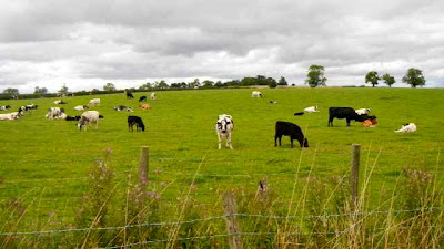
Back to the idea as to why I do this hike ... The very gregarious proprietor of the B&B where we stayed in Richmond asked us today why we didn't go on a proper holiday and see the sights or go the the beach. It's a fair question. As we've hiked we've discovered that many Brits are avid walkers. There are public foot paths in many locations. So who have we met on trail and what are some of the reasons they are doing the Coast 2 Coast? - A British man who is his mid 50s and lives on the Isle of Man was doing it because he and his wife had divorced several years ago and it seemed to be part of his healing to do this walk; a British mother and daughter who will finish her final year of secondary school were doing it to have time together prior to college; Mark, from the Netherlands, was doing it because the Netherlands is so flat and he was loving the changing geology he experiences each day; Stewart, a Brit who is about 40 was just divorced and he wanted to do something totally different than the usual beach vacations he took with his former wife; Paul, a Brit, wanted to celebrate his 50th birthday by doing the walk. He had hoped to do it with several friends but they all backed out so he decided to do it alone. Early in our hike we met 3 American men in their late 60s and early 70s and they were doing it for "bragging rights." (On one side of the trail were cattle; on the other side were sheep!)
Since Kathy and I booked early we have had B&Bs along the trail. We walk to our B&B each day and then walk out of it the next morning. There is one night when the nearest B&B is 2 and a half miles from the trail so we plan to call them to pick us up by the trail that day and take us back to the trail the next morning, I share this because we've met different hikers and hiking groups who have walked and then had a taxi or van take them back to the town where they have already been. I told Kathy that riding back in a car to where you started to spend the might would seem discouraging to me. Today we met a group of 4 hikers who had started in Richmond, hiked 14 miles to Danby Wiske, and were heading back to Richmond to spend the night.
We often need to call ahead to the B&B where we are staying to confirm an evening meal. When we called to confirm for tonight we learned that we are the only 2 guests in the village of Danby Wiske tonight. That makes us feel very special. - Nancy

Wednesday, August 28, 2013

Day 13, Wed. Aug. 28, Arandale House, Richmond


Layover day - We had a welcome rest day. The owner of the B&B even did our laundry for us. We visited Richmond Castle in the morning.
It was founded in 1077. After it was no longer used as a Castle and started to crumble it became a tourist attraction. During World War I it was used as an army garrison and a prison. There were 16 prisoners who became known as the Richmond 16
who were held as prisoners and there are inscriptions that they wrote on the walls. These sixteen were conscientious objectors and were eventually sent to France to be given a death penalty for refusing to fight in the war. News of this leaked out and they were imprisoned in harsh conditions but spared the death penalty. Even so some died in prison. The men were young. Some were Methodists, Jehovah Witness, and several Quakers. In the display in the exhibition hall about the Richmond 16 it stated that their prison sentences and suffering led to the acceptance of a person being a conscientious objector. It was a fascinating bit of Quaker history for me. We then purchased lunch for the trail tomorrow and caught up on e-mails. Later we went on a tour of the Georgian Theatre that was built in 1788. It has been restored and is in use now. We were disappointed that there was no play tonight. Tomorrow there is Globe Theatre group performing "The Taming of the Shrew."
Even on our rest day our GPS recorded that we walked 4.2 miles. We even climbed to the top of the castle and had great views of Richmond. Seeing all the chimney tops reminded me of the movie "Mary Poppins." Back on the trail tomorrow. - Nancy (Pictured below are the Richmond Gardens. - rw)

Tuesday, August 27, 2013

Day 12, Tuesday Aug. 27, Arandale Guest House, Richmond


Hiked 11 miles, 118 miles down, 74 miles to go
Today was another great day for hiking. The trail was very manageable, the weather was good, and we made good time. We made it to our B&B by 3:30. It even has a hot tub that we will use. Tomorrow is a layover day so we we explore the town of Richmond.
Today we went over many stiles and through many small gates in stone walls. My GPS said we hiked 12.4 miles.
Whatever the actual mileage we are slowly getting closer to the finish at Robin Hoods Bay. I still have one bothersome blister and Kathy's feet have ached some but we keep doing the best we can to keep going. We are thankful for a layover day tomorrow. - Nancy (Nancy says that their B&B in Richmond is at the corner of Quaker Lane and Queen's Road! - rw)
St. Andrews Church in the small town of Marrick (en route to Richmond)

Monday, August 26, 2013

Day 11, Monday Aug. 26, Cambridge House, Reeth


Hiked 11 miles, 107 miles down, 85 miles to go
Today was a lovely day for hiking. The morning started out with low fog in the moorlands but it burned off by 10 am. After hiking about 5 miles to the small village of Gunnerside
we stopped for lunch. We had a packed lunch that our B&B has provided for us and we actually sat at a picnic table and ate. The Stedman guide book that we are using had us take a high route over the moorlands. Two other hiking groups, both Brits, stopped at the same place for lunch and said they were going to take a path along the river. We decided to be brave and try a path that we had no waypoint for and no description.
It turned out to be a fairly good choice. It was a longer route which meant that we ended up walking 14 miles today. Most of the way the trail today was much easier on the feet. We walked on a lot of grass in pastures and soft dirt along the river.
There were two times I didn't like the trail. The first was when it went on top of a rock wall. The wall was about six feet off the ground. It was wide enough but it sure seemed like a ways up if one were to fall. The second place was when the path by the river just ended and that was a very steep scramble up a 30 to 40 ft. cliff to the road above the river. Kathy went up first. About half way up I said to Kathy, "I can't do this." She calmly replied, "Nancy, you can do this." I made it to the top but my legs were shaking. Our guide book said the hike today would take 4&1/2 hours. We took 8 hours. We know we are slow hikers but the guide book seems to think hikers go lots faster than we do. We followed the Swaledale Valley (pix above) all day and the views were wonderful. There were many tight squeezes through rock walls and many stiles to step over on all paths we have taken.
Today we talked with several hikers who had gone over the bogs yesterday and all said it was challenging. Their reports confirmed that we made a wise decision to hike the road. Here's a British to American translation of map terms: Beck = Stream, Dale = Valley, Fell = Mountain, Force/Foss = Waterfall, Garth = Enclosure, Ghyll/Gill = Ravine, Hause = Narrow neck of land, Ness = Headland, Pike = Peak, Rigg = Ridge, Scar = Bare Rocky cliff or crag, Tarn = Lake, and Thwaite = Clearing or meadow. Each day I am thankful for such a good hiking partner. We have an agreement that there are no apologies for going slow, stopping to adjust packs, tend to feet, or to eat, drink and rest. We just keep plugging along the way. - Nancy

Sunday, August 25, 2013

Day 10, Sunday Aug. 25 Keld Lodge, Keld


Hiked 12 miles, 96 miles down, 96 miles or go Halfway there!
Keld is the halfway point of the Coast 2 Coast trail. We crossed from the county of Cumbria into Yorkshire and into The Yorkshire Dales National Park.
We crossed the Pennines which is the Continental Divide for the North of the UK. Now all streams and rivers flow into the North Sea instead of to the Irish Sea. We've been passed on the trail daily by a British man named Stuart. Yesterday he told us that we seemed to know how to pace ourselves. We took that as a compliment. Today the guide book offered three routes. The easiest was the "low route" but all routes had lots of bogs to slosh though and try to find the trail. The low route was 14.5 miles. The low route only had 7 waypoints in 14.5 miles. The two high routes had more bogs and were 13.5 miles. I looked on Google maps and the road was only listed as 9.9 miles. After missing the trail for a bit yesterday and walking 2 extra miles and losing time we made a strategic decision to walk the road. It turned out to be 10.4 miles of walking. We left at 9 am and had the goal to arrive at 3 pm. that included stops for lunch,

fixing feet, taking pictures. We made it by 2:05 pm. Walking the road was a bit harder on our feet but sometimes we could walk on soft grass or on the pea gravel on the shoulder. We didn't see any trees for about 5 miles. Today was Sunday so there was more traffic than usual. There were quite a few motorcyclists. Lest you think it was an easy hike there were many ups and downs so it was not a leisurely stroll. From the road it's quite apparent to see how boggy the soil is in this area. This confirmed that we had made the correct decision. It seems that however we finish the day the last half mile is always hard going.
Because we didn't have to think about where to put our feet with each step I had some time for reflection. I was thinking: "What is it that motivates people to do the Coast 2 Coast walk?" What motivated me? I remember reading about the UK Wainwright Trail several years ago in the Smithsonian magazine. Here is a link the article: http://www.smithsonianmag.com/history-archaeology/A-Walk-Across-England.html. When we went backpacking I always joked about the quote in The Silver Chair by C.S. Lewis, "warm beds and hot baths in Harfang tonight." If only I could have those two things at the end of a hiking day! Now I have that. In the book the children are welcomed in to be fattened up and eaten at the Autumn Feast. I don't think any of the proprietors of the B&Bs where we're staying are interested in eating older women.
When my friend Sara couldn't go on this trip Ron said, why don't you wait a year. It was really important to me to go this year. I guess I wanted to fight the idea of retirement and not feeling old. I had a great need to defy the aging process. In the scriptures it talks about keeping your eye on the prize. Until we reach Robin Hoods Bay my eye is on that destination and the prize of arriving there. I visualize throwing the small stone I picked up at St. Bees into the North Sea. We still have a long ways to go. As Ron would say I will "keep on keeping on." - Nancy (Note: Nancy says that the Lodge [pictured below] is literally "out in the middle of nowhere," 1/2 way between 2 towns on the route. The view is from the lodge. - rw)

Saturday, August 24, 2013

Day 9 Sat. Aug. 24, Fletcher House Kirkby Stephen


Hiked 12.75 miles, 84 miles down, 108 to go
It rained most of last night so that made for very boggy trails. It was raining when we started out this morning and we missed our first turn.
We ended up walking 2 extra miles in the rain and lost about 75 minutes of hiking time as we were looking at maps and our GPS. We were with a British man who is about 40, and we finally got back the right path. I figured that the mistake would be harder to take at the end to the day when we were very tired.
I was right. Our feet were sore and we were a bit discouraged. We had hiked over lots of bogs and it seemed that half of our hiking time was trying to find a trail where you didn't sink into the mud over your boot tops. The Brits used the term that today was a "slog." That it was. At the end of the day we again lost the trail for a bit but at least we could see the town and knew we were close. We were trying to figure out how to get over stone walls and barbed wire fences when we saw small sign that said "public footpath".
We followed it a bit and saw a woman walking her dog and she got us headed in the right direction to our B&B. Showers and dinner revived us. Our daily schedule is into a routine. We get up and have breakfast at 7:30 or 8. We pack up our suitcases and haul them downstairs where Packhorse, the agency we are using, collects them to take to the next B&B. They provide luggage tags for each day that we stick on our bags so they get the right location. I doctor up my feet to prevent blisters and care for the two blisters that I do have. Kathy has had fewer blister issues. We collect our packed lunches and head out to the trail. We hike and hike. Take some breaks but this depends on the weather. We meet other hikers who pass us on the trail. We are the tortoises of the trail. We try to enjoy the views on the way and take some pictures.
We arrive at our B&B around 4:30 or 5. We drag our suitcases up to our room. We shower, eat dinner, put in GPS coordinates for the next day, send blog updates and a few pictures, talk with our husbands on Skype or Skype phone, think we will read some but fall asleep as soon as we get into bed.
I think for me to finish this hike it mainly takes a lot of grit and determination. In some ways all of the years our family went backpacking prepared me for this hike. Sometimes you just have to keep going. Today was one of those days. By missing the trail we ended up hiking 14.2 miles today. - Nancy
(Apparently today there was some kind of an equestrian competition.)

Friday, August 23, 2013

Day 8 Friday Aug. 23, Scar Side Farm, Orton


Hiked 13.25 miles , 71.25 miles down, 120.75 to go Today a perfect weather day for hiking. It was overcast but not cold. It looked like it could rain most anytime but it only spit a bit mid-day for a few minutes.
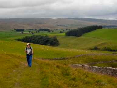
Today we hiked mainly though pastures, around stone walls and over the moors. At times we would be at the top of a hill and we could see for miles in all directions and there were no farmsteads, towns, roads - only sheep. It seemed very isolated. We saw fewer hikers today. In the Lake District there were lots of day hikers. In this region the few hikers we saw were all Coast 2 Coast hikers. (The picture below was taken on a high moor during our lunch stop.)
We often laughed about the directions in our guide book.
Here's an example, "As you reach the top of the small rise look for two isolated trees (one big , one small) on the horizon ahead of you to the left. [Trees?] The path goes just right of these, marked by posts." It seems that whatever the trail, the end of the day ends with an uphill climb. I keep hoping that each day will be a bit easier. Even if the trail is easier I find that I am tired at the end of the day. We are been fortunate about the weather, our accommodations, and our health. So far, so good. (Pictured below is Kathy in front of the ruins of the Shap [a small town] Abbey, built in 1199.)- Nancy